Hurricane a blow'n,,, batten down the hatches!

maranfilms

Veteran
Anyone preparing for the hurricane coming up the east coast?

we all know they hype the crap out of these storms just get people to tune in to their channel. Anyway, I'm on Cape Cod, so I will make a video documenting the storm. Hopefully it's
not as bad as their making it out to be.:shocked:
 
Be safe, maran. It's always exciting watching it come in, but by the time you realize you could be in trouble it's already too late.
 
Supposed to make landfall north of here. North enough that I don't think I'll need to go anywhere, but it should be awfully blow-y and rainy.

On the upside, it should put a considerable dent in this year's drought, if not eliminate it entirely.
 
Hawk with all his tornadoes & such…..now we're the ones in danger all up & down the east coast!

i hope it's not as bad as they say for everyone's safety and praying for a dry basement and no power outages. BTW, getting a generator 'round these parts is mission impossible.
 
BTW, getting a generator 'round these parts is mission impossible.

Yeah, you gotta do that in Spring or Fall. Summer is Hurricane season, and Winter is Ice season. When I lived out in the Raleigh area (for about 22 years), the ice storms would kill our power for upwards of two to three weeks. It was so cold that lighting a candle in the same room as you would eliminate the bite that was left in the air (after the multiple layers and blankets).

I also was on the east coast (at ECU) for Floyd in 1999. The town was flooded. We couldn't get to our apartment for a week, and when we did, we saw that the water line was almost on the second floor. We lived on floor three. Worked out for us, but not many others.
 
Phew! Escaped this one as it strengthened over the warmer water.
But it's supposed to be "only" Cat 1 or 2 after landfall further north.

Irene's arrival was a reminder for me- yesterday was the 19th anniversary of Cat 5 Hurricane Andrew.
I covered its landfall (nearly got blown in the Intracostal Waterway with a Betacam- grabbed the cracks in a brick wall to hold on) and the miserable, roofless aftermath for 3 months.

The season's really just starting- good luck to all and if you go out in it, be careful, always have a way out and don't go out alone!
 
Be safe, maran. It's always exciting watching it come in, but by the time you realize you could be in trouble it's already too late.

Thanks Hawk, My wife is bugging me to head up to New Hampshire for a few days till it blows over. If I didn't have a house and business here to watch over I would have already left. I cant leave knowing that if something happens and I could have been here to take care of it, it would have been my own fault. I know it's only material items, but insurance only covers so much, and without my business my family will starve and become homeless.

I do have a generator in my grip truck, and stocked up on lots of extra food, water, and batteries. This way if I lose power I can still log on to Dvx user. :)
 
maran- if it looks like you're going to take a direct hit, and you don't have storm shutters, get gear and computers out of rooms with windows.
Interior bathrooms are good because the plumbing provides extra reinforcement, interior closets are next best, and as high off the floor as possible.

Best of luck, hope you get the same "right turn" we did!
 
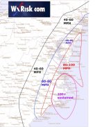
According to WXRisk, the millibars are dropping which means the hurricane is getting STRONGER and may make Cat 4:

http://www.wxrisk.com/

regionmap1.jpg

"The following forecast is going to be based upon the assuming that the current track will verify AND that Irene will be a strong category 3 or weak category 4 at the time of impact. information is going to verify.

It should be noted that at 220 pm the 12z Thursday afternoon run of the European model has now come out and it is even more stunning in its ferocity with regard to hurricane Irene then the last several runs. The model takes hurricane Irene as a category 4 hurricane showing a MSLP around 940mb as it makes landfall in Morehead City then moves over Elizabeth City –losing very little strength because of low swamplands over Eastern North Carolina tracks — then tracks over Norfolk Virginia. From there Irene bends NNE tracking over Wallops island / ocean City MD and making another landfall at Cape May New Jersey as a category 2 hurricane and eventually passing over NYC as a category 1 hurricane on Sunday afternoon.

 This is a dangerous and historic track far exceeding the intensity of any hurricane in Hampton roads and last 100 years. Hurricane Donna did not pass directly over Hampton roads in 1960 but instead tracked over Nags head and the northern outer banks of North Carolina and then headed NNE paralleling the East coast. The track here is similar but its shift to the west by 50 miles which is the European Model has Irene crossing through Hampton roads and the lower portion of the Chesapeake Bay and the lower Virginia eastern shore.

 There is No other word to describe the European model depiction of this hurricane for Northeast North Carolina southeastern Virginia ….the central and lower portions of the Chessy Bay and the lower Delmarva as anything short of catastrophic. The European model implies sustained hurricane force winds as far west as Richmond and the European model is extremely wet showing large areas of excessively heavy rains well to the Western Richmond greater than 5 inches. The European model track brings in a large area of Hurricane conditions that exceeds what was seen by Isabel …by a large margin.

 For the time bring I am NOT going to go 100% with the European solutions…."
 
I hadn't heard the barometric pressure was dropping. And the European model is certainly different from Weather Channel's:

map_tropprjpath09_ltst_5nhato_enus_600x405.jpg


Here's the National Hurricane Center's wind speed predictions (in a not as easy to read Google Map)
http://www.nhc.noaa.gov/refresh/graphics_at4+shtml/211943.shtml?gm_track#contents

And the Hurricane Center is predicting the Storm Surge probabilty of greater than 5 ft in Wilmington at 40-50%:
http://www.nhc.noaa.gov/psurgegraphics_at4.shtml?gm

If things don't worsen (and the water only gets cooler, providing less energy for the storm further north), NC will get a Cat 2, everybody else a Cat 1 or low Cat 2.
I hope this remains the worse case scenario.
 
All the local weather here pants a much less dire picture than wxrisk. I'm on the inland side of Wilmington and wind here is expected to be 40-50 mph, not 60-80.
 
Okay Maran, never say I wasn't looking out for you.......

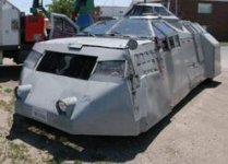
First you need one of these:

medium_casey_andthe_tornado.jpg

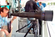
And maybe one of these for distant shots:

Biggest+zoom+lense2.jpg

and finally, as a last resort, a set like this:
scuba-gear-at-pool.jpg

There is no shot worth your safety. Even if it is the most amazing shot.....if no one gets to see it, it is a junk shot.
 
I spent the day moving my audio post studio from the basement to the upstairs. We live in a designated flood district, and I was flooded once already in '07; I had over $75,000 in damages to the studio then. At least I have some warning this time.
 
They're saying its supposed to reach DC on sat afternoon. I'll definitely be staying home that day. My neighbor hood has a front door code box. I got stuck outside once in a thunderstorm when the power went out, and that was not fun. This hurricane should have 40-50mph winds they say :/
 
I spent the day moving my audio post studio from the basement to the upstairs. We live in a designated flood district, and I was flooded once already in '07; I had over $75,000 in damages to the studio then. At least I have some warning this time.

These are strange times. I moved from Connecticut to Florida some years back and encountered many hurricanes since then....and now look. Though I miss having a basement I can't imagine the potential damage that could of happend if I did have one. You're doing the right thing by moving your stuff out of harms way. You shouldn't have to worry about the winds just the potential flood damage. Just think of it like a blizzard without the snow.
 
Back
Top